Lake Ouachita, Arkansas: Map, Depth, Size & Information
Comprehensive hydrographic guide to Lake Ouachita featuring verified USGS & USACE water statistics, interactive topographic mapping, shoreline facilities, boating ramps, and game fisheries.
Lake Ouachita Live Water Level Status & Wind Conditions
Interactive Map of Lake Ouachita
Where is Lake Ouachita?
Lake Ouachita is located in Garland, Montgomery County in the state of Arkansas, at geographical coordinates 34.5833° North latitude and 93.3833° West longitude. The water body lies at a surface elevation of approximately 578 feet (176 meters) above mean sea level.
Nearby Cities & Distances
About Lake Ouachita
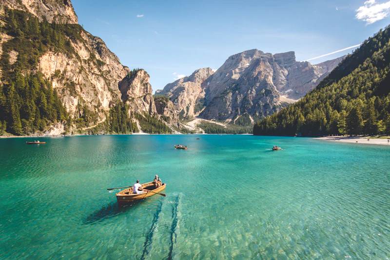
Lake Ouachita is the largest lake located entirely within Arkansas, created by Blakely Mountain Dam on the Ouachita River. Completely surrounded by the lush Ouachita National Forest, the reservoir has virtually no commercial shoreline development, preserving an undisturbed wilderness character with over 200 uninhabited islands, crystal clear diving waters, and world-class striped bass fishing.
Hydrographic Classification:
Lake Ouachita is categorized as a Ouachita River Impoundment Reservoir. Its designated primary authorized uses include Flood Risk Management, Hydroelectric Power (Blakely Mountain Dam), Water Supply, Conservation, Recreation.
Activities & Recreation
Lake Ouachita is known for its resident game fish species. Common targets include:
Popular watercraft activities permitted across regulated channels:
Boat Ramps, Marinas & Public Parks
Marinas (4)
- •Mountain Harbor Resort & Marina
- •Lake Ouachita State Park Marina
- •Brady Mountain Marina
- •Crystal Springs Marina
Public Boat Launches (4)
- •Spillway Recreation Area Ramp
- •Brady Mountain Launch
- •Crystal Springs Ramp
- •Buckville Launch
Parks & Recreation (3)
- •Lake Ouachita State Park
- •Ouachita National Forest
- •Hot Springs National Park (15 miles east)
Boating Safety, Wake Zones & Aquatic Regulations
A mandatory 100-to-200-foot no-wake zone is enforced around all public boat launches, designated swimming areas, private docks, and moored vessels. Vessel operators must maintain idle speed in narrow coves and bridge passes.
Coast Guard-approved Type I, II, or III PFDs are required for all vessel occupants. To prevent aquatic invasive species (quagga mussels, hydrilla), boaters must adhere to Clean, Drain, and Dry inspection procedures prior to launching.
Seasonal Fishing Patterns for Lake Ouachita
Game fish move into sheltered secondary coves, shallow flats (4–12 ft depth), and creek mouths as surface temperatures climb into the 50s and 60s. Target submerged timber, riprap, and emerging vegetation with spinnerbaits, suspending jerkbaits, and soft plastics.
Predators retreat to deep underwater humps, main river channel ledges, and thermocline layers (20–45 ft). Peak activity shifts to dawn, dusk, and night trolling. Use deep-diving crankbaits, spoons, drop-shots, and downrigger spreads.
Cooling weather triggers lake turnover and intense schooling feeding. Bass, trout, and walleye push baitfish into primary points and pocket coves. Fast-moving topwater plugs, lipless crankbaits, and swimbaits produce explosive strikes.
Fish consolidate around deep wintering holes (40–80+ ft) or under safe solid ice on northern waterways. Slow finesse presentations—vertical jigging spoons, blade baits, and live bait rigs—dominate the cold-water season.
Lake Ouachita Statistics & Hydrography
| Measurement | Imperial Value | Metric Equivalent |
|---|---|---|
| Surface Area | 40,100 acres | 162.3 km² |
| Maximum Depth | 200 feet | 61.0 meters |
| Average Depth | 50 feet | 15.2 meters |
| Water Surface Elevation | 578 feet above sea level | 176 meters |
| Shoreline Length | 690 miles | 1110 km |
| Lake Classification | Reservoir (Ouachita River Impoundment Reservoir) | |
| GPS Coordinates | 34.5833° N, 93.3833° W | |
Frequently Asked Questions about Lake Ouachita
7 verified answersWhy is Lake Ouachita celebrated for scuba diving?+
How deep is Lake Ouachita in Arkansas?+
What is the surface area, shoreline length, and elevation of Lake Ouachita?+
What game fish can you catch in Lake Ouachita?+
Can you boat on Lake Ouachita and where are the public ramps?+
Who manages Lake Ouachita and are there campgrounds or parks nearby?+
Where does the data for Lake Ouachita come from and how is it verified?+
Nearby Lakes to Explore
Explore More Lakes in Arkansas
Discover the largest reservoirs, alpine tarns, public boat launches, and fishing regulations across Arkansas.
View All Arkansas Lakes →Compare Lake Ouachita
See how Lake Ouachita measures up against Lake Tahoe, Lake Superior, or Lake Mead in surface acreage, depth, and volume.
Launch Comparison Tool →