Reservoir·Illinois Lakes·Clinton, Bond, Fayette County·USGS 05593000

Carlyle Lake Water Level, Wind & Map (IL)

Current water level vs. full pool, wind gust advisory status, bathymetric depth (35 ft max), public boat ramps, and shoreline recreation guide.

Directions
Surface Area
26,000 acres
105.2 km²
Max Depth
35 ft
10.7 m
Full Pool Datum
445 ft
136 m MSL
Shoreline
83 mi
134 km
Coordinates
38.652°, -89.309°
WGS84 Datum
Agency Source
USGS 05593000
Reviewed 2026-03-18
USGS 05593000·Reading: 2026-03-18 14:00 UTC·Official Gauge Source

Carlyle Lake Water Level Today & Wind Forecast

Elevation & Storage Balance
Water Level vs. Full Pool
Gauge Surface Elevation
440.98 ft
Full Pool Datum: 445.00 ft
Drought Watch
Departure from Full Pool
-4.02 ft(below)
Conservation Pool Fill Level87.1% Full
0%
25%
50%
75%
100%
Full Pool: 445.00 ft
24h Trend: ++0.05 ft / 24hEst. Storage: 249,106 acre-ft
Inflow
2,624 cfs
Tributary flow
Outflow
1,912 cfs
Outlet discharge
Water Temp
70°F
Surface Est. (12 PM)
Water Clarity
5.2 ft
Secchi depth
Hydrologic balance: Net flow is +712 cfs (Net Inflow). Elevation trend is rising +0.05 ft/day.
Modeled Surface Forecast (12 PM)
Wind, Gusts & Safety
Small Craft Advisory
Small craft advisory thresholds met (12 mph sustained with gusts to 25 mph). Expect choppy whitecaps and difficult docking.
Surface Wind Vector (12 PM)
NESW
E 95°
12 mph
Gusts: 25 mph
Wind from E (95°) · Est. Wave: 0.8 ft
Surface Chop0.8 ft est.
Rough / Whitecaps (2.0 - 4.0 ft)
Barometer
30.14 inHg
Solunar Index
Slow Bite
Hourly Forecast Scrubber12 PM · 12 mph (G25)
Water Level & Volume CalculatorModel acre-feet storage changes and shoreline shift.
Open
Embed Carlyle Lake ConditionsAdd a live wind & water widget to your marina or club site.
Get Code

Interactive Map of Carlyle Lake

38.6517° N, 89.3089° W|Get Directions
Centroid: 38.6517°, -89.3089°Open Directions in Google Maps

Location & Nearby Cities

Carlyle Lake lies in Clinton, Bond, Fayette County, Illinois at 38.6517° N, 89.3089° W. Normal conservation pool datum is 445 ft (136 m) above sea level.

Closest Municipalities (Straight-Line Miles)

Carlyle
2 mi away
Centralia
16 mi away
St. Louis
52 mi away
Springfield
85 mi away

About Carlyle Lake

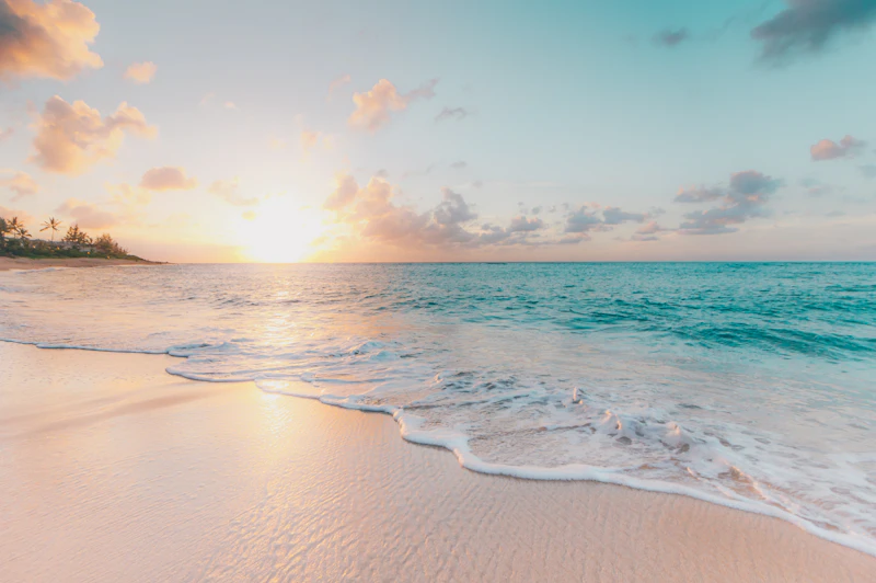
Sailboats crossing the wide open prairie horizon of Carlyle Lake in southern Illinois
Reservoir · Kaskaskia River Impoundment ReservoirReviewed 2026-03-18

Carlyle Lake is the largest man-made lake in Illinois, spanning 26,000 acres across Clinton, Bond, and Fayette counties about 50 miles east of St. Louis. Operated by the U.S. Army Corps of Engineers (St. Louis District), its wide open main basin and consistent prairie thermal winds make it a premier Midwest sailing, regatta, and crappie fishing destination.

Water Body Classification & Authorized Uses

Carlyle Lake is classified as a Kaskaskia River Impoundment Reservoir. Primary operational uses include Flood Risk Management, Recreation & Sailing, Water Supply, Waterfowl Habitat.

Fisheries & On-Water Activities

Primary Game Fish

Documented species targeted in Carlyle Lake:

White CrappieBlack CrappieLargemouth BassWhite BassChannel CatfishWalleyeSauger
Watercraft & Recreation

Popular activities across public access areas:

Sailing & RegattasCrappie & White Bass FishingPower BoatingCampingSwimming BeachesKayaking

Boat Ramps, Marinas & Public Parks

Check Official Access Closures
Dam West Boat Ramp & Recreation AreaOpen
Dam West Rd, Carlyle, IL
Managed by: U.S. Army Corps of Engineers
Hours: Open daily dawn to dusk (seasonal water shutoff Nov–Mar)
Fees/Notes: USACE Day-Use Fee ($5/vehicle or America the Beautiful Pass)
Carlyle Sailing Association HarborOpen
Eldon Hazlet State Park, 20100 Hazlet Park Rd, Carlyle, IL
Managed by: Illinois DNR / CSA
Hours: Seasonal harbor operations Apr–Nov
Fees/Notes: Slip & transient guest fees apply
Eldon Hazlet State Recreation AreaOpen
20100 Hazlet Park Rd, Carlyle, IL
Managed by: Illinois Department of Natural Resources
Hours: 6:00 AM – 10:00 PM daily
Fees/Notes: Free day-use entry; campsite fees apply

Marinas (4)

Boat Ramps (4)

Parks & Shores (4)

Navigation Rules & Aquatic Invasive Species (AIS)

No-Wake & Buffer Zones

Observe mandatory 100–200 ft idle-speed buffers around public launch ramps, fuel docks, marinas, bridges, and swimmers. Verify launch depth clearances if elevation is below normal full pool.

Safety Gear & Aquatic Invasive Species (AIS)

Coast Guard-approved PFDs are required for every person aboard. Boaters must complete Clean, Drain, and Dry aquatic invasive species (AIS) decontamination before launching to block zebra/quagga mussels and hydrilla.

Seasonal Fishing Patterns for Carlyle Lake

Spring (March – May)Post-Ice-Out & Spawn

After ice-out and spring warming, walleye, northern pike, and bass push onto rocky windswept reefs and warming back bays.

Summer (June – August)Weedlines & Deep Structure

Predators track deep outer weed edges, sunken islands, and mid-lake thermocline structure using live-bait Lindy rigs and deep crankbaits.

Autumn (Sept – November)Fall Turnover Feed

Turnover restores oxygen throughout the water column, triggering heavy feeding along rocky points prior to winter freeze-up.

Winter (Dec – February)Solid Clear Ice Season

Once state agencies report safe clear ice thickness (minimum 4 inches for foot traffic), anglers target deep basin transitions with glow jigs and tip-ups.

Carlyle Lake Hydrography & Measurements

MeasurementImperial ValueMetric Equivalent
Surface Area26,000 acres105.2 km²
Maximum Depth35 feet10.7 meters
Average Depth11 feet3.4 meters
Full Pool Elevation445 ft MSL136 meters
Shoreline Length83 miles134 km
ClassificationReservoir (Kaskaskia River Impoundment Reservoir)
GPS Coordinates38.6517° N, 89.3089° W

Frequently Asked Questions

7 answers
What is the full pool elevation of Carlyle Lake in Illinois?+
Carlyle Lake operates at a normal summer conservation pool of 445.0 feet NGVD29 and drops slightly during winter flood-control drawdown to 443.0 feet.
Why is Carlyle Lake famous for sailing in Illinois?+
Carlyle Lake features nearly 26,000 acres of uninterrupted main-basin fetch with minimal shoreline wind obstructions, creating steady 10–18 mph winds favored by Midwest sailing fleets.
How deep is Carlyle Lake in Illinois?+
Carlyle Lake reaches a maximum depth of 35 feet (11 meters), with a mean operating depth of approximately 11 feet (3 meters). Its reservoir basin features depth contours transitioning from shallow littoral flats into deeper main-channel drop-offs.
What is the surface area, shoreline length, and elevation of Carlyle Lake?+
At normal conservation pool, Carlyle Lake spans approximately 26,000 surface acres (40.6 square miles / 105.2 km²) at 445 feet above sea level, with 83 miles (134 km) of shoreline in Clinton, Bond, Fayette County.
What game fish can you catch in Carlyle Lake?+
Anglers on Carlyle Lake target White Crappie, Black Crappie, Largemouth Bass, White Bass, Channel Catfish, Walleye, Sauger. Spring spawning draws fish toward protected flats and coves, summer shifts predators to main-basin structure and thermocline depths, and autumn concentrates baitfish along windward points.
Can you boat on Carlyle Lake and where are the public ramps?+
Yes, recreational boating is active on Carlyle Lake. Public boat launch access includes Dam West Boat Ramp, Keyesport Boat Launch, Tamalco Boat Access. Full-service marinas such as Carlyle Sailing Association Harbor and Boulder Marina provide slips and marine services. Check real-time wind gusts and small craft advisories prior to departure and follow Clean, Drain, and Dry aquatic invasive species (AIS) inspection rules.
Where does the water level and hydrographic data for Carlyle Lake come from?+
Hydrographic metrics and gauge references for Carlyle Lake are sourced from U.S. Army Corps of Engineers (St. Louis District) & USGS Water Data (Station USGS 05593000) and the USGS National Hydrography Dataset (NHD). Records were last reviewed on 2026-03-18; full source links and datum notes appear on our Data Methodology page.
Primary Data Source: U.S. Army Corps of Engineers (St. Louis District) & USGS Water Data
Gauge: USGS 05593000 · Reading: 2026-03-18 14:00 UTC · Record: carlyle-lake-il
Official Agency Record